Monday 28 May 2018

The Warrumbungles

We decided to stay for a couple of nights in the Warrumbungle National Park near Coonabarabran (described as "The Astronomy Capital of Australia"), in central NSW.  Two main reasons: Firstly, to allow us to do some star-gazing through telescopes at a local observatory by night, and secondly, to do some hiking and bush walking through the picturesque landscape by day.

With the weather forecast indicating a cold but clear night was expected we booked our places for some professionally guided night-sky & telescope viewing at a privately owned observatory.  The observatory being ‘private’, rather than a government funded research institution, means they typically make their money through doing their own research and by ‘selling’ telescope access time to scientists, astronomers and enthusiasts from around the globe.  They supplement this by conducting viewing tours for tourists like us.  While we were there we could periodically hear the whirring of one of the 'telescopes for hire' being repositioned by the renter who, in this case, was located elsewhere in the world and was controlling the telescope via the internet.

Numerous 'telescopes for hire' at a privately owned observatory

The ‘tour’ included an astronomy presentation followed by our fully qualified host pointing out various stars, planets and constellations using the naked eye then through 3 different telescopes.  We managed to get a look at Jupiter and Saturn along with a number of star clusters, distant nebulae and galaxies.  It was a very enjoyable and informative experience!

The following morning, we embarked upon the longest and most strenuous hike thus far in the WTF? - Where are The Farrows? era.  The ‘Grand High Tops via Breadknife Circuit’ is 14.5km in length and took us through the national park along creek beds, up gentle and then steep climbs to to lookouts near the top of the range and back down again.

We set out around 9am and hiked steadily with pauses only to appreciate the spectacular views that were revealed around almost every turn in the trail. A brief but welcomed 15 minute picnic lunch stop was all too quickly over then back down into the valley we went.  After 5 hours we were both feeling a little foot and leg weary but we had completed the loop!

Our hike in The Warrumbungles revealed many spectacular vistas

Part of the way up!

Didn't matter which way we looked it was always impressive!

A hot shower upon return to camp was a great way to relax after the hike.  We did not stay up too long looking at the stars that night and were pretty much asleep as soon as our heads hit our pillows!

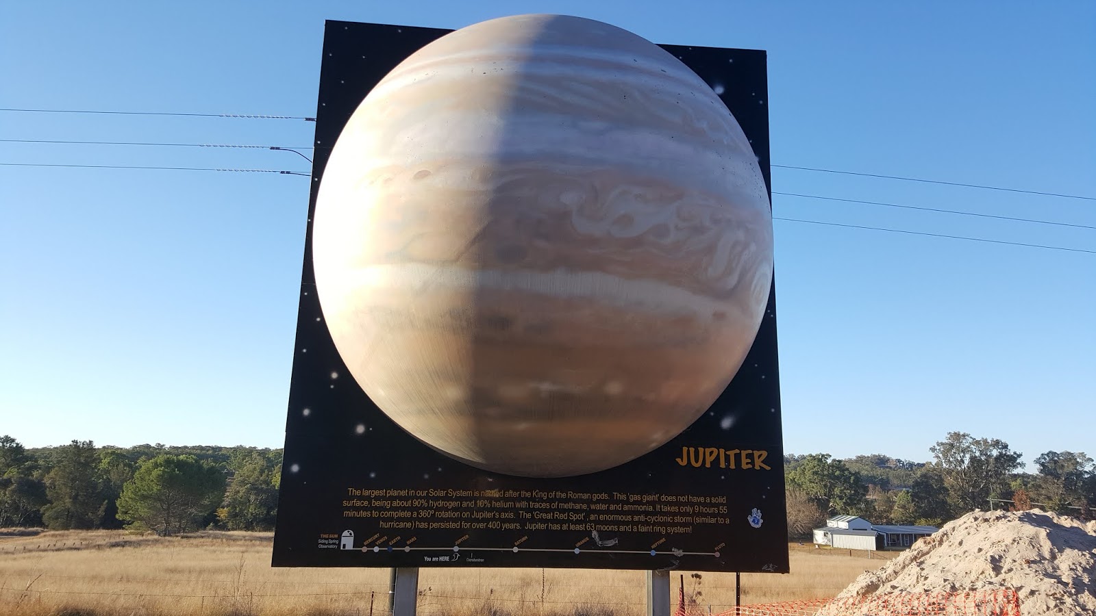
We really enjoyed our visit to the Warrumbungles and, as it turned out, it neatly wrapped up the ‘Space’ theme that our travels had taken a few days back starting with our visit to the Parkes Radio Telescope.


WTF? - Where are The Farrows?, will continue as we wend our way down the highways and byways of eastern Australia.  “Which way now?”, you ask.  “The Waterfall Way” is the answer.

Friday 25 May 2018

Virtual Solar System Drive

After watching a beautiful misty sunrise at our latest camp on the banks of the Macquarie River it was an easy 35km drive into the regional centre of Dubbo to re-supply and gather information to help us decide “What & Where to next?”.

Morning mist burning off as the sun rises over camp

As soon as we got out of the car at the Dubbo Information centre we had our answer, not just regarding “What & Where?”, but also “What route to take?”.

We decided to do "The World's Largest Virtual Solar System Drive" 

Billed as “The World’s Largest Virtual Solar System Drive”, the road trip to the Siding Spring Observatory, (a 37m diameter dome housing the 3.9m diameter Australian-Anglo Telescope), perched atop a mountain in the Warrumbungle Range, is a scaled (1:38 million) model of our Solar System.


Our route would take us to the Sun at Siding Spring Observatory from Pluto in Dubbo (starting at lower left)

The 37m diameter dome represents the Sun (actual diameter of 1.39 million km).

The Australian-Anglo Telescope is housed within the 37m diameter dome

Starting at the outer reaches of our solar system, Pluto, at this scale, is about half the size of a billiard ball and is located a mere 190 km down the highway (in Dubbo), from the Observatory (vs. 7.2 billion km in reality).  As you drive towards the Sun each of the planets are represented by billboards placed in roadside turn-outs located the appropriate distance from the Sun/Observatory along the route.

Road distances (in km) of each planet to the Sun along our route from Dubbo

We stopped at each of the billboards containing information and a scale model of each planet and learned a bit about them all.  At scale, Jupiter, the largest planet in our Solar System is ~ 3.9m in diameter and 22 km from the sun (~800 million km).

Billboard with 3.9m diameter scale model of the planet Jupiter

At the end of a fun and informative drive to the Sun we toured the dome housing the big telescope.  As it happened we were lucky enough to be in the observation room to see both the dome and telescope being repositioned for its scientific star-gazing to be done later that night.

'Selfie' from Inside the dome as the telescope was being repositioned

The cool/cold clear night skies and light-pollution free conditions present in the elevated Warrumbungle region in central NSW make it the perfect place for star-gazing.  For these reasons the Siding Spring Observatory was built here in the1960s.  The observatory is a working research facility so, unfortunately, the public has no access to the 45 telescopes that are located here.  To get a closer view of the universe you have to visit one of several private observatories located in the area.

The vista of the Warrumbungle region from the mountain upon which the observatory sits was enough for us to decide to stay in the nearby National Park for a couple of days to do some of the hiking trails.

View of some peaks within Warrumbungle National Park from the Observatory

It is hard to do justice to the scenic beauty of the park with words alone - as a result of this, in the next edition of WTF? - Where are The Farrows?, I will give the pen a bit of a rest and be heavier on the pictures.

Tuesday 22 May 2018

Lap of the Mountain

Ever since I was a small boy I have enjoyed watching Australia’s premier motor racing event, ‘The Bathurst 1000’, held each October at the Mt. Panorama circuit near the town of Bathurst.  When the route we were travelling had us driving right by the entrance to the public road / racetrack, I couldn’t NOT do a lap while I was this close!  With a flick of the indicator I turned off of the highway and took the ute/caravan combination onto the Start/Finish straight for the start of my strictly enforced 60 kph lap of the track.

As the name of the circuit suggests, Mt. Panorama is indeed a mountain.  Starting at the base you climb steeply up one side of the mountain before twisting and turning your way across the top where, if you are a passenger, there are apparently some quite ‘panoramic’ views to be had.  As the driver you can’t look or relax as just as soon as you are at the top, it is more twists and turns as you descend steeply down the other side.  Only when on a long straightaway can you loosen your grip on the wheel!

View of the track through the drivers' eyes

Even at just 60 kph with its blind corners and steep dipping bends, the track is challenging, especially when dragging a 3t caravan behind you.  It took us about 7 minutes to get around.  I now fully recognise the skills (and lunacy) of the race car drivers who hurtle themselves and their machines around here on race day in just over 2 minutes per lap at speeds approaching 300 kph!

With that boyhood dream now behind me it was time to get to our campsite before the weather we had been running from caught up with us.  Upon arrival at the location we had picked, situated halfway between Bathurst and Orange, we were a bit disappointed to find it much less sheltered than we had been hoping for but with the weather and darkness approaching we did not have time to find anything else.  We quickly set-up and hunkered down for what turned out to be three days and nights of very strong cold winds and driving rain with the odd snow flurry thrown in to boot!

Not unusual in Canada but in Australia... WTF is going on?

Too miserable to be out and about on foot and feeling too cooped up to stay in the caravan all day we made the most of a poor situation and did a couple of self-guided extended driving tours of the region.

On day one, we drove about 100 km to the east to Katoomba in the Blue Mountains to see ‘The Three Sisters’.  While the sky was clear in Katoomba and the view well worthwhile, we nearly got blown off the side of the walking trails.

The Three Sisters from Echo Point Lookout in Katoomba, Blue Mountains NSW

On day two, we travelled about 100 km to the west to visit the town of Parkes (home of the annual ‘Elvis Festival’), and the nearby Parkes Radio Telescope.  While we didn’t see Elvis (the festival is held in January not May when we were there), we did get to visit ‘The Dish’.

The Parkes Radio Telescope received and relayed the live TV images of man stepping onto the moon.

The Parkes Radio Telescope was responsible for capturing the live Apollo 11 moon walk TV signals that were beamed to Earth from the moon and then relaying them around the world for public broadcast to the millions of people sitting in front of their TVs to watch the event.

With Heather at the controls of 'The Dish', what could possibly go wrong?

We left the Snowy River Country in order to avoid the worst of a big weather system that was forecast.  That region might have gotten 60cm of snow dropped on them but I am almost certain it was just as cold where we were - it sure felt like it and I think I may have said something like WTF? (and I was not asking Where are The Farrows?).


Keep your antenna searching the ether for the next WTF? - Where are The Farrows?, where the interplanetary cosmic theme that started in Parkes, continues…

Saturday 19 May 2018

Almost a Nice Shower

We pulled out of Snowy River Country through a light but clearing fog.  The forecast wild weather was not due for a few more hours so we still had good conditions for driving, albeit a bit frosty at the outset.

We turned north and westerly to put some distance between us and the high country in order to stay out of reach of the snow storm.  After a couple of hours on the road in lovely sunny conditions we decided to stop for lunch at a bush pub that we came across enroute to our next stopover.

At this stage I must let you know the following so that you don't think of us as being dirty or strange (or both?):  In order to attract clientele to their establishments, many small town pubs in Australia offer a free hot shower to travellers in exchange for buying a drink and/or a meal in their establishment.  Being 'clean again', holds some considerable appeal to travellers who, like us, may have been 'free camping' for a while and have had limited access to hot and cold running water, other than what they can carry in their caravans or motorhomes, sufficient to really wash the smell of smoke from campfires and grime of camping off of themselves.


The Beehive Hotel in Coolac, NSW.  Showers with running water - Optional!

We went in and asked the proprietor of the empty bar if the offer of a shower with a meal was still good.


"No problem.", he said.
"There is plenty of hot water.  The shower is out the back - go ahead."

We placed our order for lunch and as I am a gentleman, said to Heather;


"Ladies first."

Heather got her kit and went to take a shower.

I did a walk-around our rig to do some basic checks to kill some time and got my shower kit ready.  It was going to be really good to have a hot shower instead of a 'bird-bath'.

At the same time as Heather emerged from the shower room, I heard the publican's wife yell out to her husband, saying:


"The power just went off."

Heather, who didn't hear this said to me;


"The pressure isn't that high, it was a bit dark in there and the exhaust fan just shut-off but the shower was nice and hot."

I told her about the power going off and as I was so eager to clean myself up a bit, I marched right in perfectly OK with the prospect of showering in the dark without an exhaust fan.

I stripped off, turned on the taps and stepped under a weak flow of water.  I thought the water might cool off quickly without any electricity so I got straight to wetting and washing my hair to get the smoke out of it.  I was pretty much done in just a minute or so when the water flow diminished to a trickle.  Oh-oh!  I directed every last dribble that fell onto me at the remaining soapy bits and luckily, by the time even the drips stopped, I was done!

As it turns out, the hotel uses bore water which is delivered using their electric pump.  No power, no pump, no water.  The water in my shower was what was left in the pipes from the upstairs accommodation section of the pub!

We ate our lunch, thanked the publican and his wife for the food, the shower (and the almost shower) then hit the road again.

In the next report, a clean WTF?- Where are The Farrows?, will describe what it was like towing a 3.5 tonne caravan with a diesel ute around Mt. Panorama, Australia's most famous motor racing circuit.  It is a steep, tight and twisting track to say the least!


Thursday 17 May 2018

Snowy River Country

Following a scenic drive along the Murray Valley Highway and a most delicious stop at a bakery in Tallangatta, we arrived at our destination.  For the next couple of days and nights we would base ourselves in the foothills of the Snowy Mountains in north-east Victoria / southern New South Wales.  At this time of autumn, many of the trees are carrying red, gold and orange leaves making for beautiful sightseeing, while the cool, crisp mountain air makes a cosy campfire a necessity more than a luxury.

We based ourselves just on the NSW side of the border on the bank of the Murray River

Riverside with crisp, clear days & cold nights made a great campsite


Heather enjoying a glass of wine and a warm fire at camp

The town of Corryong, about 13km from our campsite, is the largest township (pop ~1,200) within the Upper Murray district and is the unofficial ‘capital’ of the Snowy River Country.  Corryong was the home of a man named Jack Riley, who’s exploits on horseback gave Banjo Paterson the inspiration to write the poem “The Man From Snowy River” (first published in 1890).

Heather alongside a bronze statue of 'The Man From snowy River'

'The Man From Snowy River', Jack Riley, died at the age of 73 in 1914 and was buried in Corryong.

Jack Riley - Legendary horseman of the High Country is buried in Corryong

His headstone simply states:

In Memory Of
The Man From Snowy River
Jack Riley
Buried Here
16th July 1914

As well as the legendary stockmen and brumbies, the Snowy Mountains region is home to both Australia’s highest Mountain, Mt. Koscuisko (which we did not climb but could have and will do during the warmer days of summer), and the headwaters of Australia’s largest river - The Murray River.

A common trait shared by large rivers the world over is the obvious (but often not consciously realised) fact, that they all start out small at their headwaters.  Many years ago (mid-1990s), I happened to find myself in northern Minnesota, USA, and unintentionally, at the headwaters of the mighty Mississippi River.  It was merely a trickle and just a few feet wide at this point.  I don’t know why, but I took the time to take my shoes and socks off and walk across it to the other side.  I then turned around and walked back.  I could now say that I had walked across the Mississippi River!  With this back-story in place, and now finding myself at the headwaters of Australia’s largest river, I could not resist the temptation to also ‘ford’ the Murray on foot - just to be able to say I had done so!  So, shoes and socks off, and into the frigid stream I went.  Upon reaching the other side I had also walked from the state of NSW into Victoria as the river forms the border between these two states.

Fording the headwaters of the Murray River - it was cold & slippery!

With the feat of fording the largest rivers in both North America and Australia on foot (pun intended), now under my belt, perhaps I have laid the foundation for a worldwide quest to ‘conquer' the headwaters of the mightiest rivers on each continent?  If that is the case, I have only the Nile (Africa), Amazon (South America), Yangtze (Asia) and Volga (Europe) to go!

After strolling across the fast flowing and clear waters of the ‘baby’ Murray near Tom Groggin station, we resumed our 370km driving loop around Koscuisko National Park.  We visited the ski resort town of Thredbo where just a dusting of early season snow capped the top of the slopes, and the towns of Jindabyne and Adaminaby located on the shores of Lake Jindabyne and Lake Eucumbene respectively.  These lakes were both formed by the damming of mountain rivers during the 1950’s as part of the Snowy Mountains Hydro Scheme which is a vast hydroelectricity and irrigation project constructed between 1949 and 1974.

Once back at camp and with a warm fire lit, a check of the weather forecast revealed some cold, windy, wet and snowy weather was on its way.  With 60cm of snow forecast it was easy to decide to break camp the following morning and move on before getting blanketed in.

We had enjoyed our time in this beautiful mountain setting with crisp clear days and cold nights but with so much to see and do we had just scratched the surface of what the region had to offer.  With our departure feeling a bit rushed we vowed to return and spend some more time here during a different season of the year.


Next episode, WTF? - Where are The Farrows?, move on the avoid the snow… but do they avoid the cold?  As it turned out, ‘Out of the refrigerator and into the freezer’, was fair description of the next couple of days. 

Monday 14 May 2018

Barmah Brumbies

With slightly overcast and breezy weather accompanying us we stopped briefly in the river town of Echuca to walk through the historic Port of Echuca.  The Port of Echuca was home to a large fleet of wood-fired paddle steamers that moved wool, wheat and timber from farms located up and downstream of the port for onward overland transportation to the big city of Melbourne.  At its peak, the wharf was about 1km in length to accommodate all of the boats.

Paddle Steamers lined up at the Port of Echuca Wharf.  At it's peak, the wharf was 1 km long

We jumped back into the rig and made our way into the nearby (~30km away) Barmah State Forest where we made camp along the southern bank of the Murray River.  It was soon apparent that we were right in the middle of a Kookaburra’s home territory as he was ever-present and watching (supervising?) every move we made from vantage points in surrounding trees and even from nearby on the ground as we went about our business!

We were closely 'supervised' by this Kookaburra as we set up camp

Around 5pm, with the shadows getting longer and the light starting to dim, some slight movement in the distance caught Heather’s eye.  When she looked closer to see what it was she saw a horse a couple of hundred metres away moving slowly amongst the trees of the forest and it was heading in our general direction  As she continued to watch, another horse then another and then two more appeared amongst the trees.

Wild Brumbies grazed their way through our camp - a great experience!

These were wild horses - ‘Brumbies’!  In total, this herd of 5, clearly being led by a cautious but at ease stallion, calmly grazed their way towards and then right through our campsite.  Despite their size you could not hear them at all - their hooves not even snapping a twig as they passed through our camp.  We were able to get reasonably close (5 or 6m) without spooking them and managed to get a few good photos and some video.  This was a truly memorable experience!

A link to the video that Heather made of the Brumbies has been provided below.


While exploring in the area we came across some old but large stockyards.  The fencing posts and railings, hand-hewn from forest timbers, was still standing strong!

Hand-hewn fence posts and railings still standing firm form the Barmah Stockyard

Stock loading ramp at Barmah Stockyards

Heather managed to do some metal detecting around the location of the old homestead and managed to unearth a couple of pre-decimal coins (a 1950 Threepence, and a 1943 Kangaroo Penny), and a Jew or Jaw Harp - no doubt used to provide entertainment by station/farm hands for their colleagues as they sat around a fire at night.

Heather hard at work in search of buried treasures from the past!

1950 'Wheat-sheaf' Threepence

Following our magnificent close encounter with some ‘Barmah Brumbies’ it seems quite apropos that the next destination for WTF? - Where are The Farrows?, would be ‘Snowy River Country’, where high country horsemen and their pursuit of wild brumbies were the inspiration for poet Banjo Paterson’s epic ‘The Man From Snowy River’. 

Sunday 13 May 2018

The Golden Triangle - Victoria’s Goldfields

We spent a week and a half in the region known as the Victorian Goldfields’ ‘Golden Triangle’.  The points of the triangle are the towns of Ballarat, Maryborough and Bendigo.
Victoria's 'Golden Triangle'

Immensely rich ‘nugget’ gold discoveries in the early 1850s sparked one of the largest gold-rushes the world has seen.  Fortune-seekers from across the globe swarmed into the area to try and strike it rich.

First stop for us was a quiet shady camp on the banks of a dry creek just 10km from Ballarat (population ~ 120,000).  We based ourselves here for three days, making trips into the city each day to learn more about the place.  I will describe three points of interest that grabbed our attention in/about Ballarat.

First and foremost, of course, is Ballarat’s, rich gold mining history.  So much gold!  Over 10,000,000 ounces in ten years - all dug by hand!  One or two gullies mined by prospectors were so rich that it has been recorded thus:

The Canadian and Prince Regent gullies proved fabulously rich in alluvial gold when they were worked in 1853.  At the junction of these leads near the Canadian Creek were the famed ‘jeweller’s shops’, which yielded up to 500oz (14kg) of bright nuggety gold for every foot (30cm) mined.  This was perhaps the richest patch of alluvial gold the world has known.

In today’s money, 500oz @ US$1,300/oz, is worth US$650,000 - this value was being extracted from every linear foot that was mined!

Second, and directly related to gold, is the Battle of Eureka.  The Eureka Rebellion took place in 1854.  It was the culmination of gold miners’ objection to the cost of a miners licence (as a form of taxation), imposed by the government of the day and the heavy handed manner in which the police and military went about their enforcement of compliance.

Photo of a painting depicting the Battle of the Eureka Stockade with Red-Coated soldiers storming the stockade established by the miners 

For many, the Eureka Rebellion is identified as the ‘birth of democracy’ in Australia.  Nowadays it is common to see the Eureka Flag, which was the flag of the 1854 rebellion, as a symbol of Australian independence, of freedom from domination (foreign or otherwise).

Replica of the original Eureka Flag 
Is this a possible future Australian Flag?  Stylised Southern Cross 'Eureka' on Aboriginal Flag background. 

Third, is the magnificent tribute to servicemen and women that served in WW1, known as the Avenue of Honour.  This avenue stretches for 22 km and was established to honour each and every serviceman and woman (not just those that fell), from the Ballarat area that enlisted to serve their country in World War 1.  3,801 trees were planted along the sides of the avenue, each tree representing an individual serviceperson.  At the base of each tree is a brass plaque bearing the person’s name, rank and battalion in which they served.  At 22km in length it is one of the longest such Avenues of Honour in the world.

The 'Arch of Victory' marks the start of the 22km long tree-lined Avenue of Honour

After our time in Ballarat we moved on to spend some time in the Maryborough area and then further onwards towards Bendigo.   As with Ballarat, Bendigo (population ~ 100,000), has plenty of gold mining history on display with numerous impressive old buildings and parklands right in the centre of town.  With no disrespect to Ballarat, we felt Bendigo to be more ‘stately’ and 'liveable' than it’s more ‘gritty’ sister city of Ballarat.  We enjoyed our time in the area very much.


Next, WTF? - Where are The Farrows?, leave the goldfields behind (without any gold to show for Heather’s detecting efforts) and spend some time in the Murray Valley camping along the banks of Australia’s biggest river - The Murray River.